
Activity Feed › Discussion Forums › Strictly Surveying › Total station data error in topcon.
Total station data error in topcon.
Posted by wawefivoki on November 26, 2018 at 3:40 pmHello RPLS community. I was in a college project on land surveying and detailing. I collected all the data on TS topcon 255 model. I tried to import a file from TS but it show error message showing “zero Objects”. While i obtained the file its in some other .txt format which is not loading in excel workbook and its preety random looking which i have attached below. Is there any way to convert it to the desired format. I used topcon link to import data.
Help appreciated
SCOTT A. HARTER replied 4 years, 10 months ago 12 Members · 17 Replies- 17 Replies

I’m not familiar with that particular data collection software, but it looks like a raw data file which will require some software that can parse it. If you are looking for just coordinates out of your dc, probably there is a function in it to export a comma delimited ascii file.

So are you importing the .tsj file from the Total Station into Toplink? If so, you should be able to export a .csv file from Toplink. I haven’t used a Model 255, but, I would think my old 7000i would be similar.

Did you change the file extension to “.txt”? Are these supposed to be coordinates? Raw Data?
The Topcon Link Software you used to download the file will convert it to an ASCII text file. But you must download the file first and open it without changing the extension for the software to recognize it.

I would suspect that he is using a GTS-255, with Topcon Link. I believe in what he might be exporting, could be the raw data file, converted to a txt. I am not sure, but suspect the error is directly in how he is trying to export the file from Link. Been years since I used it, but there are plenty of youtube videos and manuals online.

It appears to be a binary file and someone changed the extension to TXT.

I have opened the file, it is a raw data file written in asc and it contains 505 points. It appears point 1 was occupied and point 2 was backsighted but no coordinates are included for 1 (CP6_). Points 3 to 53 appear to all be shot from 1 backsighting 2. Point 54 is setting (CP7_). No format I am familiar with, so take it for what it is worth.
Paul in PA

No, the software topcon link gives this file. the extension wasn’t changed. I dont know if i am getting this due to faulty device. Otherwise I tried to import data from topcon using topcon link and the end result is this file with the error message” zero object found”

I think Kevin is on it. I know I’ve seen files like this from my Topcon TS when I pressed the wrong button either on the TS or in Topcon Link. Topcon Link will likely decode this. Open this file in Link, then File/Save As & pick the format you want in the popup box & click Save (after telling it where to save the new file).

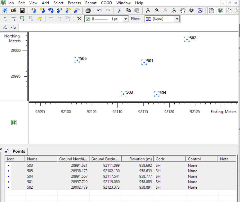
Another community college student here ??. I have the demo version of Topcon Tools at home and when I just import the file, I see some points. I don’t have to do any change in extension or anything. I just say import data, click on the .txt file, and it imports it without any error. See attached image. The demo mode limits me to 5 points, but if you have the full version, you should be able to see all your points. Once in Topcon Tools, you can easily export it to Excel. I will be on campus later this week and can test it with the full software, if you don’t solve it by then.

SOLUTION : I am not too much familiar with the software but i can see that this file can be easily exported to the working file format in small tweaks. In this document ‘+’ and “_,” separates individual columns and ‘_+’ separates the individual rows. There is this powerful text editor called “TextPad8”. I replaced first “_+” with new line feed (enter or n) and after that “+” with whitespace(space or t). Now there is still some problem i.e, the number lat, long and reduced levels are not what it need to be. So, i figured out that this file must have 3 digits after decimal.(intelligent guess though). Simply divide each columns of lat, long and reduced levels with 1000 to obtain the true value… All other unnecessary columns can be deleted. I have attached the final file and file that were generated in between . This surely helps.. 🙂 ;).
drop by if you need any help
Note: For this u need to delete the first control point data as it doesn’t fit the pattern..
thank you everyone . We couldn’t do it with any of the above . Maybe they were right people and maybe i have software problem while converting file or maybe its a TS fault. I found out that this TS was one of oldest in college and probably going for maintainance. Thanks Hillson Ghimire (we are on same group) your manual method saved huge…

I have a Topcon GTS 255 and I can download via Toplink 8.2.3 without issue and seems like I can alter the
connection settings from the standard baud 1200, 7 E, 1 to 9600, 8, N, 1 with either one way or ACK-NAK
and the file downloads.
Toplink can convert the file into a comma delimited (.txt) file.
In order to upload you have to convert that file to an .xyz through the conversion part of Toplink choosing the
model range that includes the 255.
Am having uploading difficulties at present even when using the factory com settings for the RS-232 and data transfer
and laptop com port all at 12oo, 7, E, 1.
Any suggestions?

Cable bad on pins 3, 4 or 9?
I guess that I will try another cable. Different pins used on upload versus download?
- Posted by: SCOTT A. HARTERDifferent pins used on upload versus download?
Yup
Not certain why the file came out as a text file. The format suggested that it was a RAW data file when I opened it in Notepad. So, in order to get Topcon Link to read the file correctly, I changed the extension to “.raw”
The I set the source file spec to Topcon GTS-210-310 format and specified the file I downloaded from RPLS. I then had Topcon Link convert the file to NEH coordinates. The resulting file is attached. I have no idea if it looks like what you measured. I only took what it gave me.
Jim:
Yes it was the cable.
Thanks for your reply.
Lesson learned.
Scott

Log in to reply.