
Surprise
I took on a project to survey Lot 42 in a subdivision from 1971 by a surveying and engineering company that is now defunct. Thinking all the calculations had been made, and finding several markers this was supposed to be routine.
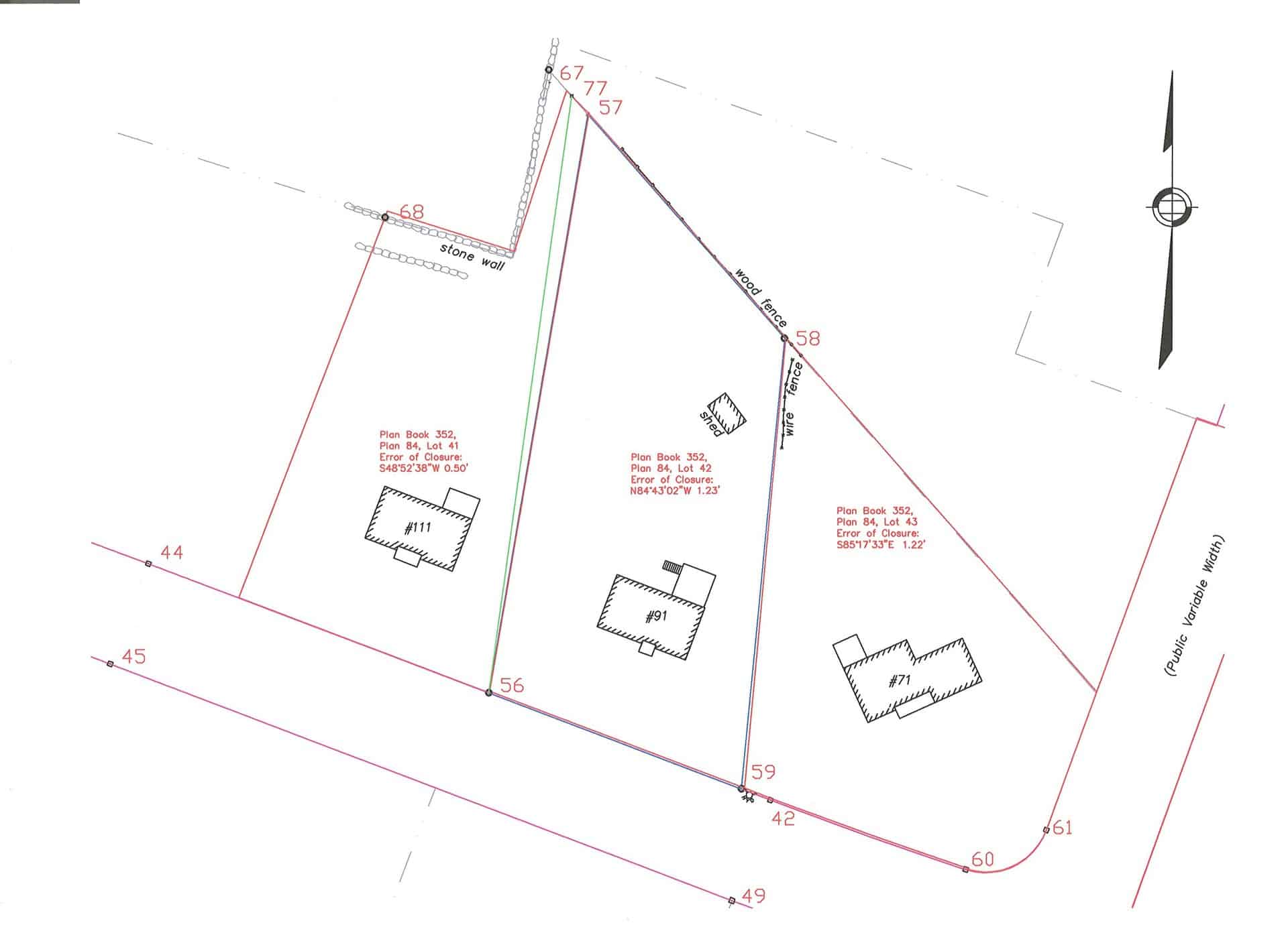
I can live with many of the positions for the corner markers found in this survey. All that were found are shown numerically on the diagram except for numbers 57 and 77. This helps because the lot lines calculated from courses and distances do not form a closed figure. I checked the adjacent lots and found similar results, but the worst was yet to come.
Point 67 was found in a stone wall, and the stone wall was surveyed for the diagram. The red lines in the diagram represent the courses and distances shown on the subdivision map. So, the surveyor may have located the wall incorrectly.
The distance measured between found corner markers 58 and 67 is 167.84 feet, which is in excess of the record measurement by 12.72 feet. Lots 41, 42 and 43 do not close and are short by 0.50, 1.23 and 1.22 feet respectively.
If I were to apportion the excess along the north boundary the corner would be point 77 and the west boundary would be the green line.
If I allow the entire excess to go to Lot 41 the corner would be point 57 and the reason would be that it was due to the location of the wall being incorrectly surveyed or calculated… or whatever. This approach kind of follows the shape of the subdivision lot.
If I go out and find a marker at the northwest corner of Lot 42 then the entire problem is moot. And I thought this was going to be easy.

Log in to reply.