
Activity Feed › Discussion Forums › Strictly Surveying › “Section Subdivision”
“Section Subdivision”
Posted by tjnap on January 20, 2020 at 7:01 pmWhat subdivision method should be used to define quarters and quarter-quarters of Section 5, T 20 N, R 5 W, Claiborne Parish, Louisiana? Can you provide an applicable reference section in the Manual of Instructions for the Survey of the Public Lands of the United States? Thanks.
holy-cow replied 4 years, 3 months ago 9 Members · 13 Replies- 13 Replies

The north tier is not lotted. Surveyed in 1822. Did they set quarter section corners?

get the Patent history (dates) for all of the patents in the section

I’ll stipulate from the get-go, that my work has never involved much in the way of urban, suburban, or residentcial scenarios.
That said, the FIRST documentaion (after the “deed”) that I want to look at, is the Federal Records (Plat, “field notes,” Historical Index, and ORIGINAL Patents) relating to the property and its adjoiners.
When you see a “deed” that says somthing like;
“Beginning at the Northwest Corner of the Southeast ?¬ of the Southwest ?¬ of Section X, Thence North 660 feet, Thence East 1320 feet…”
And the the Original Patent is for the Northwest ?¬ of the Southwest ?¬ of Section X, THAT is a different scenario that if the Original Patent is for the ENTIRE Southwest ?¬ (IMO).
As with Chaos Therory, Initial Conditions define what happens NEXT, and Complexity Theory alters the path with each choice (document) that comes along thereafter.
Edit: I forgot an IMPORTANT aspect in the Complexity part…each physical action (fence building, roads, occupation, etc.) also factor in big time (in most cases).
“When you come to a fork in the road, take it.” But you have to be on the right road to start with, if you hope to get where you need to be.
Loyal

Depends on the official “instructions” that were in force in 1822, apparently. Start with that.

The area with the huge reservoir? Good luck, that could be a big survey if no records of original corners exist. Hopefully some of the lands were surveyed when they built the dam.

Don’t know as the Field Notes cannot be found.

Use the field notes from the GLO surveyors. I briefly looked at them this morning, and it looks like they set all section corners and quarter corners. If you have to resort to a full retracement survey, I recommend that you consider using it for finding or restoring the corners in the same place that GLO set them. Under normal circumstances, I would also recommend at least initially considering that the pro-rating would come from the proportionate distances GLO recorded on the survey if you have to go to the very last resort of pro-rating which is often dangerous, and in that case might also recommend boundary agreement. I would not normally find a pro-rating or closing corner instruction more reliable than simply trying to follow what the GLO did and last resort pro-rating using the GLO’s numbers.
That is an old survey in some tough terrain and where much appears to be disturbed. Boundary agreement might be highly recommended in case someone decides to build the Mariott Hotel one inch from the section line next to the water a couple years down the road.
@frank-willis
Frank…where did you find the field notes? Thanks
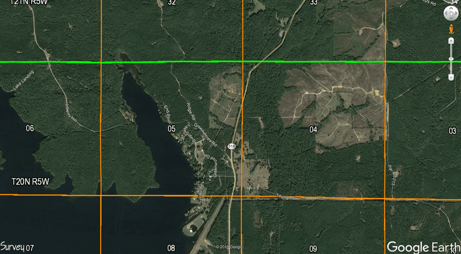
It looks like Section 4 may be subdivided:
Louisiana State Land Office. I have most of their records for townships here in my office.
send me an email. [email protected]
I’m teaching class at LSU this afternoon, but when I get back, I’ll see if I can’t help you get what you need.
The crossing of somewhat straight lines that are probably power lines in the eastern part of Section 4 reminded me of some early roads in an adjacent county to my home county. They had approved quite a few roads that were diagonals from something like the NE section corner to the SW section corner. In a couple cases I recall the road ran from the NE corner of a section to the southwest corner of a section about four miles to the west.

Log in to reply.