
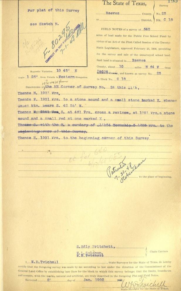
NEc Sec. 25, Blk. C-19, PSL Sur., Reeves Co., Tx
W.D. Twichell was mapping out unsurveyed public school lands between senior railroad surveys that were either sparsely or not monumented at all in the Fall of 1901, working through Christmas and into 1902. Twichell was owed several thousand dollars (almost $80,000 in modern terms) by the State of Texas. At this point of the survey, he was running a traverse line along the proposed section lines as best he could determine. On January 2, he was working north on the west side of the Pecos River.
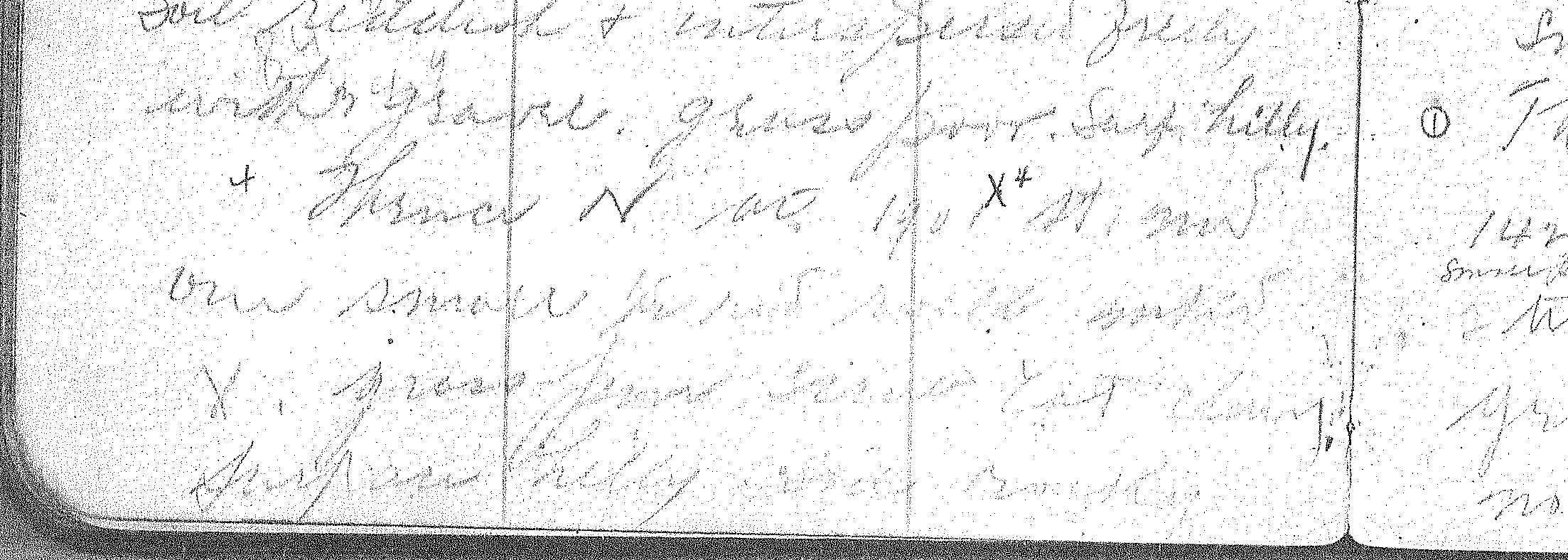
“Thence N at 1901 X4 St mnd one small ?? red rock mkd X. grass poor scrub cat claw. surface hilly soil rocky”
Not sure what the marks are in front of the word red. Kind of looks like 1/2? Sorry I can’t provide a better copy.
Twichell would make pencil notes in the field and then usually would retype the notes onto the final form in the office. The pencil notes are shorthand metes and bounds and refer to the monument id (X4) in the field book. The pencil notes for Section 25 read:
Beginning at NE 24
Th N 1901
W ” to X5
S at 461 x rav. at 1901 X4
E 1901
Here are the typewritten Field Notes:
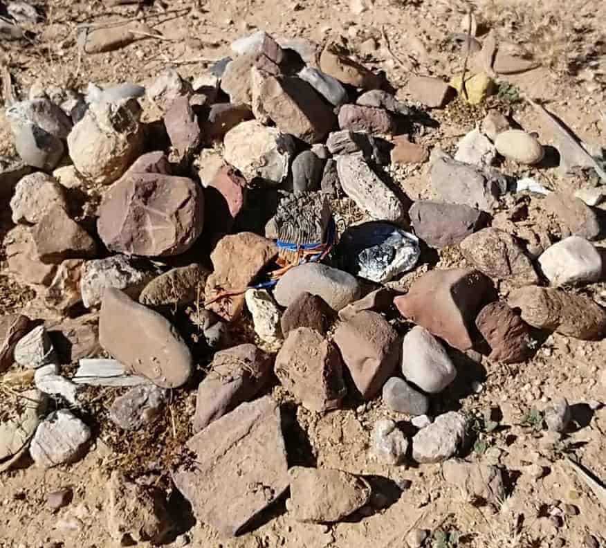
Here’s what was found:

I believe I’ll call this a match. Possible that someone has touched up the X a little, but the mound fits relative to other corners.


Log in to reply.