
How big is the Big Fill?
On the original alignment of the Transcontinental Railroad, about 4 miles NE of Promontory UT where the “golden spike” ceremony was held, there is a massive piece of earthwork known as the Big Fill. It is still clearly visible on aerial images at lat. 41.64115, lon. -112.47921.
The Big Fill was built in early 1869 by the Central Pacific. It took three months’ work by 500 men with shovels and 250 horse-drawn carts.
Stephen Ambrose, in his excellent book about the Transcontinental Railroad, “Nothing Like It On Earth,” gives the volume of the Big Fill as 10,000 cu. yd. The National Park Service, which operates the Golden Spike National Monument, uses the same figure. That yardage, according to Ambrose, was a pre-construction eyeball estimate by Leland Stanford, the president of the CP.
I got curious about the fill volume while looking at the aerial and thinking about Stanford’s background. He was neither a surveyor nor an engineer. He began his career as a lawyer, and then was a wholesale grocer and a politician before going into the railroad business.
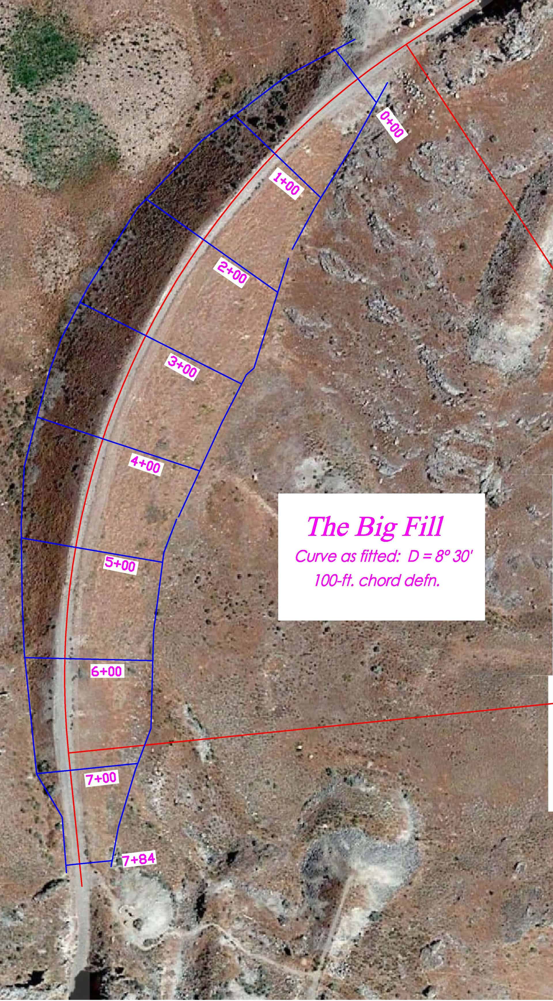
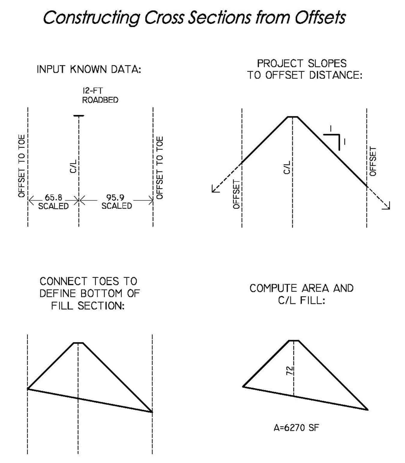
It turned out to be possible to make a rough check of the Big Fill’s volume by scaling offsets from the centerline to the toe of slope on the aerial, making assumptions about the slope ratio, and synthesizing some cross sections. Here’s a plan view–
Here’s an example of how the sections were constructed–
This .pdf gives a larger plan view–
I ran the calc with an assumed 1.5:1 slope and again with a 1:1 slope. I had no centerline profile, contours, or any other elevation data, so the height of the embankment was backed in from the slopes and the toe offsets as shown above. The elevations all remain unknown. But the areas of the fill sections should be reasonably accurate if the slope ratio is correct.
The 1.5:1 slope calc gives a fill volume of about 70,000 cu. yd. The 1:1 slope calc gives a fill volume of about 108,000 cu. yd.
The 1:1 slope, or something close to that, seems more likely. Both the Central Pacific and the Union Pacific built their lines as fast as they could, planning to upgrade them later as necessary. They were being paid by the mile. And backing in the 1:1 slope gives a maximum centerline fill of about 70 feet, which agrees with a figure given by the NPS, source unknown.
Of course a calc of this kind is not as accurate as a field survey, but it gives an order of magnitude. If anyone wanted to check it in the field, the embankment doesn’t seem to have suffered much erosion in the past 150 years.
I would be interested in any information that others might have about the Big Fill.


Log in to reply.