
Activity Feed › Discussion Forums › Strictly Surveying › How bad an error
How bad an error
Posted by ridge on October 11, 2018 at 5:25 pmNew subdivision plat. Four sided boundary. Description is right. The boundary description takes you around the boundary. Two of the lines on the plat are flipped, North East and South East instead of South West and North west. Being corrected with new plotted Mylar.
How bad is this error? Description is right and bearing distances on the map are correct just flipped bearings.
thebionicman replied 5 years, 6 months ago 15 Members · 20 Replies- 20 Replies

It is a common mistake Surveyors do, when I plotting up the deed if it does not close or just has a line going where it is not suppose to go, the first thing I check is the bearings making sure they were not flipped.
To a Surveyor not a bad error more annoying than anything, but one that we all can make.

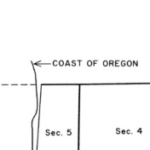
@lrday the Map shows 4 vectors that are actually correct? if so Then it is Not an error at all.
Perhaps unconventional labeling depending on local custom… the Lines are the Lines

“New Subdivision Plat”?
On most subdivision plats, only the outbounds of the entire subdivision are in what might be called order. There is no reason that very single lot must be marked in bearings such that every individual lot closes perfectly.
Please re-explain your problem.
Paul in PA
 Posted by: LRDay
New subdivision plat. Four sided boundary. Description is right. The boundary description takes you around the boundary. Two of the lines on the plat are flipped, North East and South East instead of South West and North west. Being corrected with new plotted Mylar.
How bad is this error? Description is right and bearing distances on the map are correct just flipped bearings.
If I understand you correctly there is no error. Except for the rare exception of the local jurisdictions that require a specific order to the bearings, this is entirely up to the surveyor. Sometimes a specific direction may result in having to “educate” an attorney, local government official, or title company employee, and I know some surveyors have a specific order and direction that they like to go, but in those cases only the surveyor signing the mylar can decide how bad they think the “error” is.

Its not an error at all!

Around here that is called a “Scrivener’s Error” and is easily corrected with re-recording the plat.
Andy

I do not consider that to be an error. Poor practice, perhaps, if we are talking about an exhibit map (ie/Exhibit B) to go with the legal description (Exhibit A)

When subdividing, the description in the owners certificate and the dimensions on the plat should match. I wouldn’t put out a plat that didn’t, but as a County Surveyor I wouldn’t reject it either. There is no law, rule or ordinance where I work that demands the directions read the same, only that they match.

Barring any statute, local ordinance, etc. forbidding it, bearing labels on lines on a plat that do not match the direction in the boundary description is in no way an error, let alone anything that would even come close to invalidating the plat, or indicating the surveyor was incompetent or not meeting a standard of care. I wouldn’t waste the mylar “fixing” it.

It was sort of an “error” that I made. It took all of 30 seconds to bring them up in TBC and click “flip the bearing”. I should have been more careful. It did take me 5 hours to get a new Mylar and deliver it to my client with new signatures. So a wasted day in a sense. The county demanded the change and to fight it would have delayed and harmed my clients project. It won’t happen again. I didn’t consider it a “fatal” mistake. The description is correct and the map is right, but whatever!

You’re not the first to do that. I’ve had the same issue with the checkers. I know of one surveyor who puts both directions on the plat if there are more than one description for a line. I’ve even watched two argue about which side of the line to put the labels. I checked out at that point. It isn’t a mistake to me, but it’s usually a big deal to the checkers. Did they already review it before everyone signed?

Take care of the client’s needs first. It is not something I would worry about one way or the other. However, most people who lack our familiarity with bearings would assume an error had been made.
first check: all lots must be labeled clockwise.
second check: lines may not be labeled twice
third check: all lots must be labeled clockwise.
etc.

I attempt to have all my platwork read clockwise.
Some tracts are so small they get a direction on one side of the line and distance on the other.
Rookie interns from clerk, title and attorney offices get “read in” once and after that I don’t even call back.
“I attempt to have all my platwork read clockwise.”
I don’t believe that is possible unless you are only depicting one parcel.
The bigger issue here is that some are still writing metes and bounds descriptions for perfectly good surveyed lots…..

I don’t care about clockwise vs counter-clockwise, but try to make them all flow the same way. Obviously, it can’t always match if you have more than one lot, unless you put multiple labels on the same line, which is redundant, and I’m against.
If there’s a curve that’s tangent to one line, but not to another, then I’ll usually make the direction go so the curve comes off the tangent.
No surveyor will really care, but I’ve seen so many descriptions written by non-surveyors that botch the directions, not knowing that SE and NW are the same bearing, just reversed.
- Posted by: aliquot
The bigger issue here is that some are still writing metes and bounds descriptions for perfectly good surveyed lots…..
Metes and bounds descriptions of lots are a horrid thing. We are talking about the description of the exterior boundary in the ‘certificate of owners’ (or whatever it’s called in other jurisdictions).
 Posted by: thebionicman
When subdividing, the description in the owners certificate and the dimensions on the plat should match. I wouldn’t put out a plat that didn’t, but as a County Surveyor I wouldn’t reject it either. There is no law, rule or ordinance where I work that demands the directions read the same, only that they match.
@thebionicman In the case of Oregon, I’ve always wondered what exactly this means. ORS 92.050 (below) says “conforming” but Black’s Law Dictionary didn’t really leave me with a better understanding than before. Specifically, “… the proper courses and distances of all boundary lines, conforming…” is the requirement. All elements exactly the same (direction around the boundary, directions of the lines, distances, etc) is clear enough; it is “conforming.” At a certain point if there is a different direction around the boundary, the directions of lines are reversed or mixed, or the distances require math (East 200′ vs East 100’… East 100′) it would probably no longer be “conforming.” The map and surveyor’s certificate must generally match, but any thoughts on what exactly “the proper courses and distances of all boundary lines, conforming to the surveyor??s certificate…” means?
ORS 92.050 (https://www.oregonlegislature.gov/bills_laws/ors/ors092.html)
…
(5) The locations and descriptions of all monuments found or set must be carefully recorded upon all plats and the proper courses and distances of all boundary lines, conforming to the surveyor??s certificate, must be shown.
Cheers, Eli
Conforming (in this context) simply means ‘congruent’. Do the words of the description and the map represent the same locations on the ground? In the case of flipped bearings I would say they do.
The map provides context that words alone cannot convey. If you are calculating a closure, it would be silly to ignore what you see and intentionally run backwards for one or more courses. You inherently know which way you are going and flip the bearings without thinking about it.
On the flip side, some dipstick will probably call you when ‘your map doesn’t close’. The cost of a new mylar weighed against talking to an idiot (with the power to halt your project) is negligible.
Hope that helps, Tom
Log in to reply.