
Activity Feed › Discussion Forums › GNSS & Geodesy › North American-Pacific Geopotential Datum of 2022 (NAPGD2022)
North American-Pacific Geopotential Datum of 2022 (NAPGD2022)
Posted by leegreen on December 8, 2017 at 12:26 amDiscussing the new North American-Pacific Geopotential Datum of 2022 Part 4 from GPS World.
 geeoddmike replied 6 years, 4 months ago 4 Members · 5 Replies
- 5 Replies


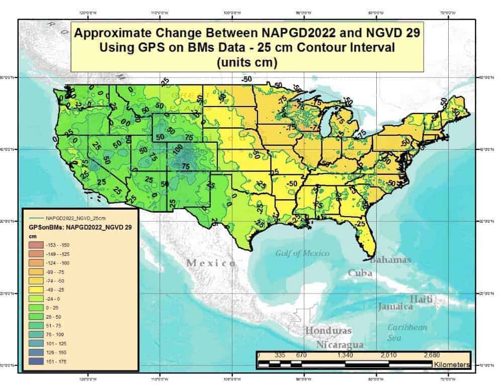
It puts us just about back to NGVD 29…
I had to explain to two members of my office that the Prototype Elevation at the bottom of the OPUS report is not the correct elevation to use yet. It is nice that they added SPCS in feet, perhaps they should add Ortho Height in feet there as well.

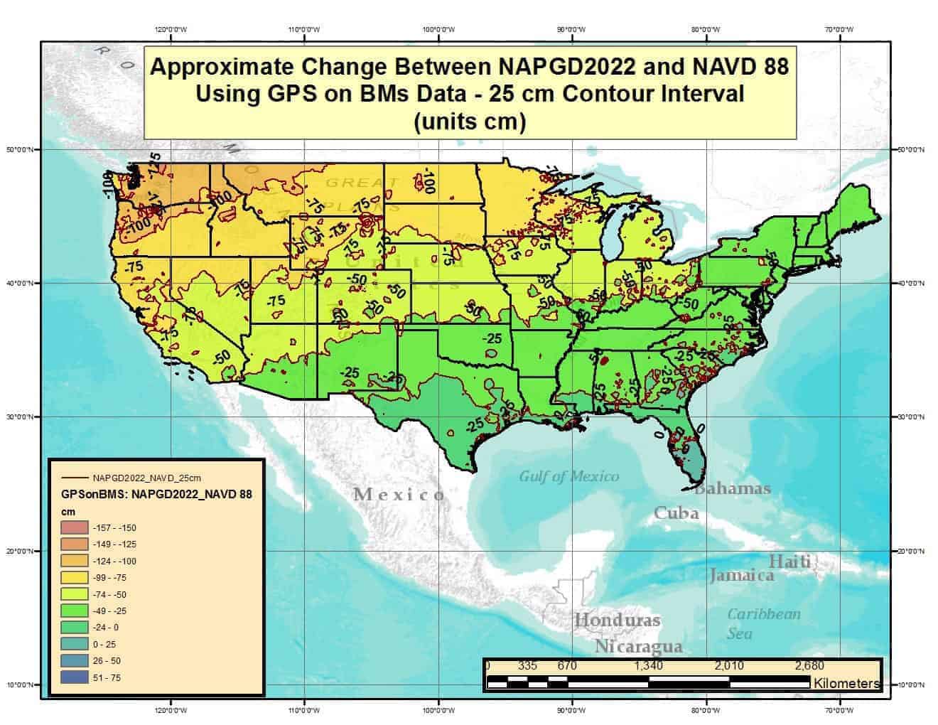
When I look at the graphic comparing NAPGD2022 to NGVD29, I am struck again by the extent and magnitude of problems in the NGVD29. See the linked article.
As for the problems getting users to correctly determine the meaning of various elements on OPUS reports as well as NGS datasheets, the metadata is there and should be reviewed. Especially when a change in format or elements occur.
I am unable to either attach image files, edit my posts or delete them on this site. What do you (spledeus) mean when you see the new datum as going back to NGVD29?
It appears that my problem attaching graphics was an iPad issue; I am using my MacBook.
As can be seen in this graphic from the article, there were significant problems with NGVD29 as a network. Note the differences from the systematic shifts from NAVD88 with the many convoluted shifts (see the Great Lakes region in particular).

As your graphic shows, in my area (Portland, OR) the difference between 2022 and ’29 will be very small. The difference between ’29 and ’88 is quite large in this area – in excess of 3 feet. Surveyors of c.2050 will look back at the ’88 datum as having been a big mistake.
Part of the design of NAVD88 was to deal with local sea level variations that distorted the nationwide network. The unfortunate differences in heights in the NW between datums is due in large part to the removal of the NGVD29 constraints at coastal tide gauges. As they definition of the geoid is an equipotential surface of the earth??s gravity field that best represents global mean sea level in a least squares sense, the new gravity-based datum will of course remove the cross-continent buildup of ??error? due to the choice of one constraint.
While flawed, NAVD88 was a significant improvement over NGVD29. For a more detailed exposition see: https://www.ngs.noaa.gov/PUBS_LIB/NAVD88/navd88report.htm
While it seems to be only yesterday, 1988 was almost thirty years ago. Work on the adjustment started years before the release date. Lots of new modeling and data from a various of sensors (including GRACE) have identified features of the gravity field not then known or understood.
NAVD88 is linked to the gravity field; NGVD29 was not.
I never liked leveling. Performing it was tedious; the corrections many and some problematic (refraction). Establishing, updating and maintaining a nationwide leveling network is hard (especially when resources are tight).

Log in to reply.